Manila–Cavite Expressway
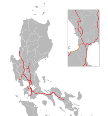
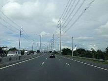
Expressway in the PhilippinesThe Manila–Cavite Expressway, signed as E3 of the Philippine expressway network and R-1 of Metro Manila's arterial road network, is a 14-kilometer-long (8.7 mi) controlled-access highway linking Manila to the southern province of Cavite in the Philippines. At its north end, it feeds into and from Roxas Boulevard in Parañaque, Metro Manila, also part of R-1. At the south end, it splits into two termini along the north coast in Kawit, Cavite. The first feeds into the intersection of Covelandia Road, Tirona Highway and Antero Soriano Highway. The second southern terminus is an exit-only to Tirona Highway in Barangay Marulas.
Read article
Top Questions
AI generatedMore questions
Nearby Places

Bacoor
Component city in Cavite, Philippines

Battle of Zapote River
Battle between Filipino and American forces during the Philippine–American War

Zapote Bridge
Bridge in and Bacoor, Cavite

Zapote station
St. Dominic College of Asia
Private college in Cavite, Philippines

Sarao Motors
Filipino automotive manufacturing company

Zapote River (Philippines)
River in Luzon, Philippines

Las Piñas General Hospital and Satellite Trauma Center
Government hospital in Las Piñas, Philippines


